Quick Answer: How Long is the Mt Kootaloo Hike?
You're considering the Mt Kootaloo hike and the existing search results aren't quite cutting it.
Old personal blogs, generic park listings, a trail app that lumps the summit walk in with the full island circuit. You want a straight answer on how long it takes, how hard it actually is, what's at the top, and whether you can do it on a day trip without rushing. As the island's operator, that's the answer below: trail facts, realistic timings, the WWII radar station story, and the practical detail that decides whether you book the morning ferry or the next sailing.
The Mt Kootaloo hike is a 7-kilometre return walk to Dunk Island's 271-metre summit, taking around three hours through shaded rainforest to a panoramic lookout and the rusted remains of a WWII radar station.
At a glance:
- Distance: 7 km return
- Elevation: 271 m at the summit
- Time: 2.5 to 3.5 hours return for a moderately fit walker
- Difficulty: moderate — graded by Parks Queensland as Class 3
- Surface: unsealed forest track, mostly shaded
- Trailhead: Sand Spit area on the eastern side of the beach - accessibility may be impeded during king tides
- Top of the walk: lookout with views to the Family Islands plus the ruins of No. 27 Radar Station (1942)
- Drinking Water on track: none — bring at least 2 L per person
This makes Mt Kootaloo the marquee activity for a Dunk Island day trip — feasible on a single ferry crossing if you take the early sailing, and one of the best half-day walks on the Tropical North Queensland coast.
Table of Contents
- Quick Answer: How Long is the Mt Kootaloo Hike?
- Where the Mt Kootaloo Trail Starts
- What to Expect on the Way Up
- The Summit, the Lookout, and the WWII Radar Station
- How Long Does the Mt Kootaloo Hike Really Take?
- What to Bring and Wear
- Mt Kootaloo vs the Dunk Island Circuit
- Pairing the Hike with a Day Trip
- FAQs
- Ready to Walk It?
Where the Mt Kootaloo Trail Starts
The trailhead is at the end of Brammo Bay. Turn left off the jetty and walk along the foreshore past the old resort. At the end of the beach you'll walk into the trail signposts.
A few things to know at the trailhead:
- The fork to Muggy Muggy Beach. Early in the walk the trail divides. Right climbs to Mt Kootaloo. Left drops to Muggy Muggy Beach (a flat 30-minute walk, no climbing, lovely swim). The signage is clear, but easy to miss in conversation — confirm you've taken the Mt Kootaloo arm before you settle into a pace.
- Phone reception. Patchy at times depending on your carrier. Tell someone your plan if you're hiking alone.
- No bins on the track. Whatever you bring in, you pack out.
The trailhead is a fifteen minute stroll from the jetty and campsites.
For the official map, download the walking trails map before you sail.
What to Expect on the Way Up
Most of the climb happens in the first two kilometres. The track is unsealed rainforest path, gradual rather than steep, with switchbacks that take the edge off the gradient. You'll be in shade for almost the entire ascent, which is the trail's saving grace — Tropical North Queensland humidity is the bigger challenge than the climb itself.
Expect:
- Dense rainforest. Tall canopy, palms, strangler figs, vines, occasional glimpses through to the coast.
- A gradual, sustained gradient. Not a staircase, not a scramble. Steady puffing for most fitness levels.
- Buttress roots and a few boulders crossing the path — not a problem in proper shoes, awkward in flip-flops.
- Birdsong, not silence. The forest is alive. Listen for whistlers, fruit doves and metallic starlings.
- Mosquitoes after rain. Repellent helps.
Plan to stop and look rather than push through. The forest is the half of the walk that the lookout photos don't capture.

The Summit, the Lookout, and the WWII Radar Station
The summit of Mt Kootaloo is the highest point on Dunk Island at 271 metres above sea level. The reward is twofold: a clean panoramic view from the Mt Kootaloo lookout, and the rusted, atmospheric ruins of No. 27 Radar Station.
The lookout view
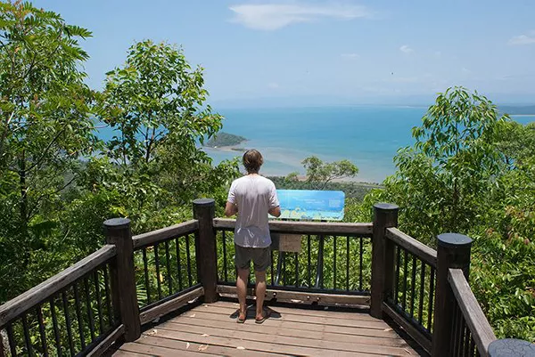
From the lookout you can see the rest of the Family Islands — Bedarra, Wheeler, Coombe, Smith and the smaller cays — spread across the Coral Sea to the south and east. To the west, the Cassowary Coast mainland sweeps from Mission Beach to Tully and the green spine of the Wet Tropics rainforest. On a clear day the view runs to the horizon. On a hazy day it's atmospheric in a different way. There isn't a bad day on this lookout in the dry season.
The radar station
A short walk from the lookout sits No. 27 Radar Station, established by the Royal Australian Air Force in 1942 during the Second World War. The station was part of Australia's coastal radar network covering the approaches to Townsville and the Coral Sea — a strategic position chosen for elevation and clear sightlines across open water.
What's left today is a quiet collection of concrete footings, rusted iron, machinery fragments and the unmistakable silhouette of an antenna mount. The rainforest has reclaimed most of the site, and you walk through it rather than around it. The combination — Pacific war history overgrown by tropical forest, on a small island most travellers had never heard of — is what makes the Mt Kootaloo walk genuinely unusual. Few hikes on the east coast deliver a story with this kind of weight at the top.
Treat the site as you would any historical ruin: look, photograph, don't climb on or remove anything. The site is protected.
How Long Does the Mt Kootaloo Hike Really Take?
The honest answer depends on pace and stops. As a rough guide:
- Fit hiker, minimal stops: 2 hours return.
- Average pace, a few photo stops: 2.5 to 3 hours return.
- Relaxed walker, lookout lunch, radar station exploration: 3 to 3.5 hours return.
- Family with younger kids: 4 hours, plan accordingly.
For a day trip, take the early ferry from Mission Beach (08:45 departure from Mission Beach). This gives you a comfortable buffer — landing around 09:10, on the trail by 09:30, summit by 11:00, back at the jetty by 13:00. You can swim, eat at the restaurant and still make the 3:30pm afternoon return ferry without rushing.
What to Bring and Wear
There are no taps on the trail and no shops once you're past the jetty. Pack accordingly.
- Water. Minimum 2 L per person, more in summer.
- Enclosed walking shoes. Trail runners or hiking shoes — the track is unsealed and root-crossed. Thongs and slides aren't safe.
- Light layers. A breathable T-shirt, optional long sleeves for sun and mozzies, swimwear for a post-walk dip.
- Sun protection. Hat, sunscreen, sunglasses — the lookout itself is exposed.
- Insect repellent. Mosquitoes and occasional sandflies, especially after rain.
- Snacks. A sandwich and an apple beats summit hunger.
- Phone with offline map. Download the walking trails map ahead of time.
- Camera. The radar station and lookout are both worth the photo.
- Cash or card for lunch at the restaurant on your way back to the jetty.
Skip the heavy pack. This is a half-day walk, not an expedition.
Mt Kootaloo vs the Dunk Island Circuit
Some travellers tackle the Dunk Island Circuit, a longer loop that includes Mt Kootaloo and continues through Palm Valley to Coconut Beach and back along the western coast. Here's how the two compare so you can self-select.
| Mt Kootaloo summit return | Dunk Island Circuit | |
|---|---|---|
| Distance | 7 km return | 11–13 km loop |
| Time | 2.5 – 3.5 hours | 5 – 7 hours |
| Difficulty | Moderate | Moderate to challenging |
| Highlights | Summit lookout + radar station | Summit + Palm Valley + Coconut Beach + west-coast views |
| Day-trip feasible | Yes, on early ferry | Marginal — better as an overnight visit |
| Best for | First-time visitors, families with older kids | Experienced walkers, overnight guests |
If it's your first visit and you're on a day ferry, do Mt Kootaloo. If you're staying overnight and want a full hiking day, the circuit gives you more variety. Either way, save time for swimming.
Pairing the Hike with a Day Trip
Mt Kootaloo is the single best reason to plan a Dunk Island day trip. The rhythm that works:
- Jump on the 08:45 ferry from Mission Beach. See current Dunk Island ferry timetable for sailing days.
- Hike Mt Kootaloo (allow up to three hours return).
- Lunch at the jetty-side restaurant when you're back on the beach.
- Swim off the beachfront — dry season, no stingers; summer, in a stinger suit.
- Catch the afternoon return ferry.
If you'd rather not rush back, book a night in the Beachfront Eco Tents. The hike becomes a far more relaxed proposition when the boat isn't ticking.
Plan the timing of your visit with the Dunk Island Seasons guide — May to September is the sweet spot for hiking Mt Kootaloo. Dry, cooler, low humidity, no marine stingers if you swim afterwards.
FAQs
How long does the Mt Kootaloo hike take?
The Mt Kootaloo hike takes around three hours return for a moderately fit walker, covering 7 kilometres of unsealed rainforest track to the 271-metre summit and back.
How difficult is the Mt Kootaloo hike?
The Mt Kootaloo hike is moderate — graded Class 3 by Parks Queensland. The track is unsealed and climbs steadily, but the gradient is gradual and the canopy keeps the walk shaded. Humidity is the main challenge, not the climb.
Is the Mt Kootaloo trail suitable for kids?
The Mt Kootaloo trail suits active children aged roughly eight and up, with adult supervision. Younger or less confident kids will find the duration and humidity tiring. For families with little ones, the flatter walk to Muggy Muggy Beach is a better fit.
Can you do the Mt Kootaloo hike as a day trip from Mission Beach?
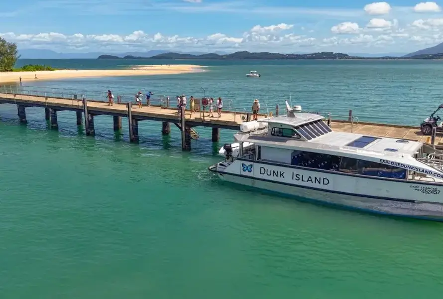
Yes. You can do the Mt Kootaloo hike as a day trip from Mission Beach if you take the morning ferry (08:45 sailing). The afternoon ferry doesn't allow enough time. Allow three hours for the walk plus time for lunch and a swim before the return crossing.
Is there water on the Mt Kootaloo trail?
No, there is no water on the Mt Kootaloo trail. Carry a minimum of 2 litres per person, and more in summer. Refill at the jetty or restaurant taps before you start.
What can you see at the top of Mt Kootaloo?
At the top of Mt Kootaloo you can see a panoramic lookout across the Family Islands, the Coral Sea and the Cassowary Coast mainland, and the rusted ruins of No. 27 Radar Station — a WWII RAAF coastal radar site established in 1942.
What's the difference between Mt Kootaloo and the Dunk Island Circuit?
Mt Kootaloo is a 7-kilometre return walk to the summit and back. The Dunk Island Circuit is an 11–13 kilometre loop that takes in the summit, Palm Valley and Coconut Beach. Mt Kootaloo suits a day trip; the full circuit is better for overnight visitors.
Are there snakes or crocodiles on the trail?
Crocodiles are rarely seen around Dunk Island, however all waterways in Far North Queensland are considered croc country so never venture off pathways - especially in mangrove areas. Snakes are present but rarely dangerous — make a little noise as you walk, watch where you step over logs, and they'll keep to themselves. Far more common: large goannas crossing the track.
Ready to Walk It?
If you've decided Mt Kootaloo is on your list, book a ferry seat first. Check the current Dunk Island ferry timetable and aim for the early sailing. If you'd rather not rush the return, book a night in the Beachfront Eco Tents and turn the hike into a slower, fuller day.
For everything else on the island — beaches, wildlife, the shorter walks — see activities and wildlife on Dunk Island. The summit's been there a long time; it's well worth the climb.
We acknowledge the Djiru People as Traditional Custodians of Coonanglebah, "Island of Peace and Plenty", and pay our respects to Elders past and present.